Mark Doodes Planning Consultants
  • Home
  • About Us
    • Meet the Team
    • The role of a Planning Consultant
    • How we work
    • Terms & Conditions
    • Insurance & Legals
  • Services
    • Pre-Auction Advice
    • Site Appraisals
    • Pre-Applications
    • Planning Strategy
    • Planning Applications
    • Land Promotion
    • Barn Conversions
    • Heritage Projects
    • Professional Objections
    • Appeals
  • Specialist Services
    • Heritage & Conservation
    • Topography & Land Survey
    • Ecology & Biodiversity Survey
    • Highways & Transport
    • Trees & Landscape
    • Soil Percolation Tests
    • Flooding: Sequential and Exception Tests
    • Computer Generated Images
    • Drone Surveys
  • Projects
    • Barn Conversions >
      • Full Planning Permission, Blewbury, Oxfordshire
      • Full Planning Permission, Corsham
      • Class Q, Wootton Fields Farm Barn
      • Class Q, Royal Wootton Bassett Big Barn
      • Class Q, Gainfield, Faringdon
      • Class Q, Granborough, Aylesbury Vale
      • Full Planning Permission, Ampney Crucis, Cotswolds
      • Class Q, Sutton Courteney
      • Stable Barn Conversion, Longcot
      • Barn conversion to four dwellings, Reading
    • Self-Build Projects >
      • Chisleborough, Somerset
      • Replacement Dwelling, Cotswolds
      • Garden Subdivision, Baughurst
      • Brownfiled Subdivision, Stadhampton
      • Wantage, Oxfordshire, OX12
      • The Riverbank, Windsor
      • Innovative green roofed self build, Gerrards Cross
      • Collingbourne-Ducis (in Conservation Area)
      • Wantage AONB
      • All Cannings Plot Subdivision
      • Barn-Like Dwelling, Didcot
      • Drayton Mill
      • Hillgreen AONB
      • Broad Town Swindon
      • South Cerney
      • Oxford (Green Belt)
      • Devizes, New Build
      • Netheravon - Wiltshire
      • Maidenhead, Berkshire
      • Granborough, Buckinghamshire
    • Large Developments >
      • Stanton St Quintin - 17 Units
      • East Sussex, 40 Dwellings
      • Staines Old Fire Station
      • Stadhampton 14 Units
      • Blackheath Station Car Park Redevelopment
      • Lydiard Millicent 9 Units
      • Bedfordshire, 21 dwellings
      • Shabbington 15 Units
      • Stadhampton 21 dwellings
    • Small Developments >
      • Abingdon, 2 dwellings
      • Little Milton 5 Units, Oxfordshire
      • Harwell 4 Dwellings
      • Little Chalfont Replacement Dwelling
      • Granborough Replacement Dwelling
      • Oxford 4 Dwellings
      • Camberley 2 Dwellings
      • Peterborough 3 Dwellings
      • Sutton Courtenay 3 Dwellings
      • Brightwalton 3 Dwellings
      • Wiltshire 4 Units
      • Polgooth, Cornwall - New Dwelling
      • Southmoor, Kingston Bagpuize, Oxfordshire
    • Strategic Land >
      • Clevedon, North Somerset
      • Stourport, Worcestershire 60-70 Units
      • Taunton, Land south of
      • Troon, Cornwall
      • Wythall, Birmingham
      • Various Co-op Disposals
      • Shurdington, Cheltenham
    • Commercial Projects >
      • Retail and Residential Development Wroughton, Wiltshire
      • Multi Use Gaming Area, Witney, Oxfordshire
      • Commercial Premises Expansion
      • Commercial Car Park Expansion
      • Ducklington Office Space
      • Major commercial expansion
      • Dog Exercise and Relaxation Business Wanborough, Wiltshire
      • Light Industrial Commercial Scheme
    • Equestrian Projects >
      • Equestrian project with restaurant, Addington, Buckinghamshire
      • Equestrian Indoor Arena, West Wellow, Hampshire
      • Goosey Stables
      • Indoor Equestrian Arena Durley
      • Outdoor arena Braziers End Buckinghamshire
      • Manege extension, Mortimer, Reading
      • Barn Conversion into Office and Living Accommodation, High Wycombe
      • Equestrian Project, Olney, Milton Keynes
      • Wigginton, Hertfordshire
      • Commercial Indoor Arena, Stratford-on-Avon, Warwickshire
    • Heritage Projects >
      • Blewbury, Oxfordshire
      • Listed Thatched Cottage in East Hendred
      • West Hanney Listed Building
      • Stanford in the Vale Listed Building
      • Staines Old Fire Station
      • Buscot Park Renewable Heating Project
      • Modern works to Listed Building, Wiltshire
    • Domestic Alterations >
      • Fire Damaged Building Reconstruction
      • Maida Vale NW8
      • Barn Restoration, Chalgrove
      • Kintbury, Hungerford, RG17
      • Change of Use Weston on the Green
      • Renovation of The Old Schoolhouse
      • Barn Change of Use Chalgrove
      • 2 Ancillary Outbuildings Near Witney
      • Midgham, West Bekshire
  • Sites for sale
    • Abingdon, Oxfordshire, OX14
    • Manningford Bruce, Pewsey, Wiltshire
    • Honey Lane, Cholsey
    • Sites Sold >
      • Blewbury, Oxfordshire, OX11
      • Wantage, Oxfordshire, OX12
      • Ball Hill, Newbury, Hampshire, RG20
      • Royal Wootton Bassett, Wiltshire, SN4
      • Royal Wootton Bassett, Wiltshire, SN4
      • Bishopswood, Baughurst, RG26
      • Maulden, Bedfordfordshire, MK45 2AE
      • Stadhampton, Oxfordshire, OX10
  • Advice
  • News
  • Events
  • Contact
  • Jobs

Areas of outstanding natural beauty

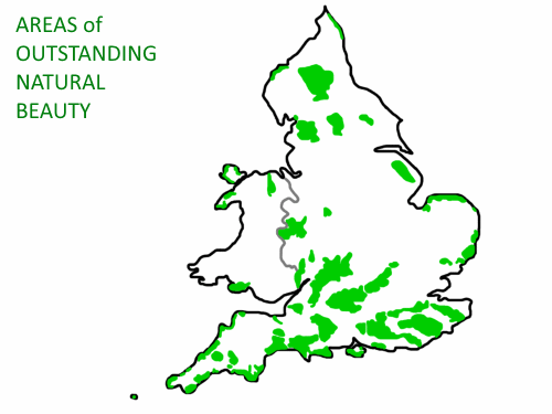
What is an Area of Outstanding Natural Beauty (AONB)?
An Area of Outstanding Natural Beauty (AONB) is an outstanding landscape whose distinctive character and natural beauty are so important that it is protected in law in the national interest.

How is an Area of Outstanding Natural Beauty protected?
An Area of Outstanding Natural Beauty (AONB) is designated and protected under the 1949 National Parks and Access to Countryside Act. Its protection was further enhanced by the Countryside and Rights of Way Act, 2000 (CRoW2000).

How many areas of AONB are there in England and Wales?
38

Does land in an AONB have permitted development rights?
Permitted development rights are reduced, but not wholly removed in AONBs. It is always worth seeking out professional knowledge and support when applying for development within an AONB. 


Picture
interactive map
AONB Name & Size
Location
County/Counties
Arnside and Silverdale
​29 sq miles

www.google.com/maps/place/Arnside/@54.1871254,-2.8822712,11.75z/data=!4m5!3m4!1s0x487c9a46b01a8037:0xda8596faf3d5cada!8m2!3d54.203808!4d-2.83275529
Cumbria, Lancashire  
Blackdown Hills
​140 
sq miles
www.google.com/maps/place/Blackdown+Hills+AONB/@50.8662705,-3.2642211,10.75z/data=!4m5!3m4!1s0x486d8d8703b1fa3d:0xcb80ac3466c608dd!8m2!3d50.918783!4d-3.2258561
Devon, Somerset
Cannock Chase
​26 
sq miles
www.google.com/maps/place/Cannock+Chase+AONB/@52.7472247,-2.0762619,12z/data=!4m5!3m4!1s0x487a0b38e9898b17:0xa461df485a3af42b!8m2!3d52.755881!4d-2.0044109
Staffordshire
​Chichester Harbour
​14 
sq miles
www.google.com/maps/search/chichester+harbour+aonb/@50.8087875,-0.9490651,12.5z
Hampshire, West Sussex
Chiltern Hills
​322 
sq miles
www.google.com/maps/place/Chiltern+Hills+AONB/@51.6597551,-0.8850486,12.25z/data=!4m5!3m4!1s0x48765f080f3be6b9:0xdea1d4697751d669!8m2!3d51.655789!4d-0.8514493
Buckinghamshire, Central Bedfordshire, Hertfordshire
​Cornwall
​370
 sq miles 
www.google.com/maps/place/Cornwall+Area+of+Outstanding+Natural+Beauty/@50.2798466,-5.0963819,10.5z/data=!4m5!3m4!1s0x486b0d2d20401789:0xa1b30e30f64b97ea!8m2!3d50.2654523!4d-5.0538508
Cornwall
​​Cotswolds
​787 sq miles
www.google.com/maps/search/cotsworld+aonb/@51.8795539,-2.3113417,9.75z
Bath and North East Somerset, Gloucestershire, Oxfordshire, Warwickshire, Wiltshire, Worcestershire
​Cranborne Chase and the West Wiltshire Downs
​
​380 sq miles
www.google.com/maps/place/Cranborne+Chase+AONB/@50.9575567,-2.1145768,12.25z/data=!4m5!3m4!1s0x4873a4e9bd93f545:0x9f987f8f694f0c7a!8m2!3d50.9559809!4d-2.0715265
Dorset, Hampshire, Somerset, Wiltshire
​
Dedham Vale
​35 sq miles

www.google.com/maps/place/Dedham+Vale+AONB/@51.9861879,0.9017302,13.25z/data=!4m5!3m4!1s0x47d907b2de7a5a29:0x94480f87aeb8246b!8m2!3d51.9767168!4d0.9296728
Essex, Suffolk
​Dorset
​436 sq miles
​
436 sq miles
www.google.com/maps/place/Dorset+AONB/@50.6929179,-2.6251293,11z/data=!4m5!3m4!1s0x48725a0ed878e74b:0xf389509e4f0062ad!8m2!3d50.686605!4d-2.549514
Dorset
​East Devon
103 sq miles​

103 sq miles
www.google.com/maps/search/east+devon+aonb/@50.7158441,-3.2524885,12z/data=!3m1!4b1
​Devon
Forest of Bowland
​
103  sq miles
www.google.com/maps/place/Forest+of+Bowland+AONB/@53.9380879,-2.5172548,9.5z/data=!4m5!3m4!1s0x487b82207222e343:0xa97f9bb6b361ff5f!8m2!3d54.0158928!4d-2.4706445
Lancashire, North Yorkshirere
​High Weald
​
560 sq miles
www.google.com/maps/place/High+Weald+AONB/@51.0487719,0.4264446,13.25z/data=!4m5!3m4!1s0x47df42642ea86f5f:0x18549b0517b2e382!8m2!3d51.0489786!4d0.4458703
East Sussex,  Kent, Surrey, West Sussexx
​Howardian Hills
​
79 sq miles
www.google.com/maps/place/Howardian+Hills+AONB/@54.1425112,-1.0255513,12.75z/data=!4m5!3m4!1s0x487ed23f26d5ea63:0x634f01b212ca78f3!8m2!3d54.1399589!4d-1.0075028Value
North Yorkshire
​Isle of Wight
​
73 sq miles
www.google.com/maps/place/Isle+of+Wight/@50.6712436,-1.4679908,11z/data=!3m1!4b1!4m5!3m4!1s0x48748787e55a5639:0x7439ce5142be7c51!8m2!3d50.6938479!4d-1.304734
Isle of Wight
​Isles of Scilly
​
6.2 sq miles
​www.google.com/maps/place/Isles+of+Scilly/@49.9283108,-6.4686952,11.75z/data=!4m5!3m4!1s0x48400928ddbd637d:0xffc2b5fad137bae8!8m2!3d49.9277261!4d-6.3274966
Isle of Scilly
​Kent Downs
339 sq miles
​
www.google.com/maps/place/Kent+Downs/@51.1744946,0.9500705,13.25z/data=!4m5!3m4!1s0x47df29b8c70feb93:0xb91acfded172d405!8m2!3d51.1722755!4d0.9692338
Greater London, Kent
Lincolnshire Wolds
220  sq miles
www.google.com/maps/place/Lincolnshire+Wolds+AONB/@53.3784392,-0.1499458,11.75z/data=!4m5!3m4!1s0x48787e5d4b7cf593:0x4d2637607741087b!8m2!3d53.3860166!4d-0.1455561
Lincolnshire
Malvern Hills
41​ sq miles
www.google.com/maps/place/Malvern+Hills/@52.1006596,-2.3421191,12.5z/data=!4m5!3m4!1s0x4870f8ab29fd181f:0x9b7ee06c7acc4529!8m2!3d52.1035321!4d-2.337761
Gloucestershire, Hereford, Worcestershiree
​Mendip Hills
77 sq miles
www.google.com/maps/place/Mendip+Hills+Area+of+Outstanding+Natural+Beauty/@51.2947642,-2.7254925,11.5z/data=!4m5!3m4!1s0x48721e7aaded3165:0x2f08d77ff507d400!8m2!3d51.2949093!4d-2.7037501
Somerset
Nidderdale
233 ​ sq miles
www.google.com/maps/place/Nidderdale+AONB/@54.1216174,-1.739995,12.25z/data=!4m5!3m4!1s0x487c00c30d2dba6d:0xf454051c00166a82!8m2!3d54.1159935!4d-1.7291892
North Yorkshire
​Norfolk Coast
175 sq miles
www.google.com/maps/place/Norfolk+Coast+AONB/@52.9684431,0.8153651,13.5z/data=!4m5!3m4!1s0x47d7717845ea9edd:0x5b2564ec5b28600e!8m2!3d52.9668986!4d0.8321288
Norfolk
​North Devon Coast
66 sq miles
www.google.com/maps/place/North+Devon+Coast/@51.1244757,-4.2390407,13.5z/data=!4m5!3m4!1s0x486c24601a87baa3:0x23bc131b998f0515!8m2!3d51.1329103!4d-4.2375322
Devon
​North Pennines
766  sq miles
www.google.com/maps/place/North+Pennines+AONB/@54.7023918,-2.8416462,9z/data=!3m1!4b1!4m5!3m4!1s0x487c4b62d94446d1:0x340dcda8a9d87aaa!8m2!3d54.6763094!4d-2.2566861
County Durham, Cumbria, Northumberland, North Yorkshire 
​Northumberland Coast
53 sq miles
www.google.com/maps/place/Northumberland+Coast+AONB/@55.531787,-1.6353394,14.25z/data=!4m5!3m4!1s0x4880a9599b94b25b:0xb6c08f96fe582290!8m2!3d55.5363567!4d-1.6332122
Northumberland
​North Wessex Downs
670 sq miles
www.google.com/maps/place/North+Wessex+Downs+AONB/@51.4022713,-1.4847965,12.5z/data=!4m5!3m4!1s0x487153521d7b259d:0xebcf50cef935459d!8m2!3d51.4133405!4d-1.4937543
Hamspshire, Oxfordshire, Swindon, West Berkshire, Wiltshire
​Quantock Hills
38 sq miles
www.google.com/maps/place/Quantock+Hills+AONB/@51.1278492,-3.3091179,11z/data=!3m1!4b1!4m5!3m4!1s0x486df09725ab8e1b:0xf493a9b1696c95e0!8m2!3d51.1255659!4d-3.1909064
Somerset
​Shropshire Hills
310 sq miles
​www.google.com/maps/place/Shropshire+Hills+AONB/@52.4870851,-2.9048087,12z/data=!4m5!3m4!1s0x48700d96693f476f:0xac102fb6adaeee6c!8m2!3d52.486373!4d-2.8590502
Shropshire
​Solway Coast
44 sq miles
www.google.com/maps/place/Solway+Coast+AONB,+Maryport/@54.8433943,-3.3820037,9.5z/data=!4m5!3m4!1s0x487d25eb27ef643d:0x774ee1c26d6c1b55!8m2!3d54.9290816!4d-3.2409112
Cumbria
South Devon
130 sq miles
www.google.com/maps/place/South+Devon+Area+Of+Outstanding+Natural+Beauty+(AONB)/@50.2652348,-3.782382,13.25z/data=!4m5!3m4!1s0x486d1d1f08a02f5f:0xc84943b53f104226!8m2!3d50.2683805!4d-3.763898
Devon

Suffolk Coast and Heaths
​
156 sq miles
www.google.com/maps/place/Suffolk+Coast+%26+Heaths+AONB/@51.9659181,1.0860227,11.75z/data=!4m5!3m4!1s0x47d90b3e77084dc5:0x65d49a1c5bb99fa3!8m2!3d51.9571854!4d1.1381714
Suffolk
​Surrey Hills
163 sq miles
www.google.com/maps/place/Surrey+Hills+Area+of+Outstanding+Natural+Beauty/@51.2534673,-0.3104196,13.21z/data=!4m5!3m4!1s0x4875dd569e3197b1:0x245c43725082c595!8m2!3d51.253113!4d-0.31195
Surrey
Tamar Valley
73 sq miles
www.google.com/maps/place/Tamar+Valley+AONB/@50.4805554,-4.166595,10.75z/data=!4m5!3m4!1s0x486c8c936d6c5555:0x936c87e4bd2cfc24!8m2!3d50.5023403!4d-4.1893872
Cornwall, Devon
Wye Valley
126 sq miles
www.google.com/maps/search/wye+valley+aonb/@51.7369496,-2.8041208,9.75z
Gloucestershire , Herefordshire
Disclaimer: Information correct at Feb 2022. It is advised not to make any purchases based on information on this page.  
MARK DOODES PLANNING
​

​About Us
Contact
MDP Blog
Terms & Conditions

​Site Map


PROJECTS

Small Developments
Large Developments
Self Build Projects
Barn Conversions
Heritage Projects
Equestrian Projects
Commercial Projects


OUR SERVICES
​

Site Appraisals
Planning Applications
Barn Conversions
Heritage Projects
Professional Objections
Planning Appeals


USEFUL LINKS

Planning Portal
NPPF
NSBRC
RTPI

01865 600 555​
020 3290 2702
​©COPYRIGHT2023. ALL RIGHTS RESERVED   
Certain links in this website will lead to websites which are not under the control of Mark Doodes Planning. Mark Doodes Planning aims to include links to websites that provide relevant and useful information. We do not link to individual personal websites and will not knowingly provide links to sites that contain illegal, malicious, offensive or misleading information. Where an organisation has regional or local services and associated websites, we will only link to their national website.
​
When links are activated you will leave this website and Mark Doodes Planning has no control over and will not accept responsibility, or liability, for any material or service contained on any linked website. Links provided on the website do not represent any endorsement or other acceptance of responsibility or liability by Mark Doodes Planning for any content provided or available on such sites.
  • Home
  • About Us
    • Meet the Team
    • The role of a Planning Consultant
    • How we work
    • Terms & Conditions
    • Insurance & Legals
  • Services
    • Pre-Auction Advice
    • Site Appraisals
    • Pre-Applications
    • Planning Strategy
    • Planning Applications
    • Land Promotion
    • Barn Conversions
    • Heritage Projects
    • Professional Objections
    • Appeals
  • Specialist Services
    • Heritage & Conservation
    • Topography & Land Survey
    • Ecology & Biodiversity Survey
    • Highways & Transport
    • Trees & Landscape
    • Soil Percolation Tests
    • Flooding: Sequential and Exception Tests
    • Computer Generated Images
    • Drone Surveys
  • Projects
    • Barn Conversions >
      • Full Planning Permission, Blewbury, Oxfordshire
      • Full Planning Permission, Corsham
      • Class Q, Wootton Fields Farm Barn
      • Class Q, Royal Wootton Bassett Big Barn
      • Class Q, Gainfield, Faringdon
      • Class Q, Granborough, Aylesbury Vale
      • Full Planning Permission, Ampney Crucis, Cotswolds
      • Class Q, Sutton Courteney
      • Stable Barn Conversion, Longcot
      • Barn conversion to four dwellings, Reading
    • Self-Build Projects >
      • Chisleborough, Somerset
      • Replacement Dwelling, Cotswolds
      • Garden Subdivision, Baughurst
      • Brownfiled Subdivision, Stadhampton
      • Wantage, Oxfordshire, OX12
      • The Riverbank, Windsor
      • Innovative green roofed self build, Gerrards Cross
      • Collingbourne-Ducis (in Conservation Area)
      • Wantage AONB
      • All Cannings Plot Subdivision
      • Barn-Like Dwelling, Didcot
      • Drayton Mill
      • Hillgreen AONB
      • Broad Town Swindon
      • South Cerney
      • Oxford (Green Belt)
      • Devizes, New Build
      • Netheravon - Wiltshire
      • Maidenhead, Berkshire
      • Granborough, Buckinghamshire
    • Large Developments >
      • Stanton St Quintin - 17 Units
      • East Sussex, 40 Dwellings
      • Staines Old Fire Station
      • Stadhampton 14 Units
      • Blackheath Station Car Park Redevelopment
      • Lydiard Millicent 9 Units
      • Bedfordshire, 21 dwellings
      • Shabbington 15 Units
      • Stadhampton 21 dwellings
    • Small Developments >
      • Abingdon, 2 dwellings
      • Little Milton 5 Units, Oxfordshire
      • Harwell 4 Dwellings
      • Little Chalfont Replacement Dwelling
      • Granborough Replacement Dwelling
      • Oxford 4 Dwellings
      • Camberley 2 Dwellings
      • Peterborough 3 Dwellings
      • Sutton Courtenay 3 Dwellings
      • Brightwalton 3 Dwellings
      • Wiltshire 4 Units
      • Polgooth, Cornwall - New Dwelling
      • Southmoor, Kingston Bagpuize, Oxfordshire
    • Strategic Land >
      • Clevedon, North Somerset
      • Stourport, Worcestershire 60-70 Units
      • Taunton, Land south of
      • Troon, Cornwall
      • Wythall, Birmingham
      • Various Co-op Disposals
      • Shurdington, Cheltenham
    • Commercial Projects >
      • Retail and Residential Development Wroughton, Wiltshire
      • Multi Use Gaming Area, Witney, Oxfordshire
      • Commercial Premises Expansion
      • Commercial Car Park Expansion
      • Ducklington Office Space
      • Major commercial expansion
      • Dog Exercise and Relaxation Business Wanborough, Wiltshire
      • Light Industrial Commercial Scheme
    • Equestrian Projects >
      • Equestrian project with restaurant, Addington, Buckinghamshire
      • Equestrian Indoor Arena, West Wellow, Hampshire
      • Goosey Stables
      • Indoor Equestrian Arena Durley
      • Outdoor arena Braziers End Buckinghamshire
      • Manege extension, Mortimer, Reading
      • Barn Conversion into Office and Living Accommodation, High Wycombe
      • Equestrian Project, Olney, Milton Keynes
      • Wigginton, Hertfordshire
      • Commercial Indoor Arena, Stratford-on-Avon, Warwickshire
    • Heritage Projects >
      • Blewbury, Oxfordshire
      • Listed Thatched Cottage in East Hendred
      • West Hanney Listed Building
      • Stanford in the Vale Listed Building
      • Staines Old Fire Station
      • Buscot Park Renewable Heating Project
      • Modern works to Listed Building, Wiltshire
    • Domestic Alterations >
      • Fire Damaged Building Reconstruction
      • Maida Vale NW8
      • Barn Restoration, Chalgrove
      • Kintbury, Hungerford, RG17
      • Change of Use Weston on the Green
      • Renovation of The Old Schoolhouse
      • Barn Change of Use Chalgrove
      • 2 Ancillary Outbuildings Near Witney
      • Midgham, West Bekshire
  • Sites for sale
    • Abingdon, Oxfordshire, OX14
    • Manningford Bruce, Pewsey, Wiltshire
    • Honey Lane, Cholsey
    • Sites Sold >
      • Blewbury, Oxfordshire, OX11
      • Wantage, Oxfordshire, OX12
      • Ball Hill, Newbury, Hampshire, RG20
      • Royal Wootton Bassett, Wiltshire, SN4
      • Royal Wootton Bassett, Wiltshire, SN4
      • Bishopswood, Baughurst, RG26
      • Maulden, Bedfordfordshire, MK45 2AE
      • Stadhampton, Oxfordshire, OX10
  • Advice
  • News
  • Events
  • Contact
  • Jobs